

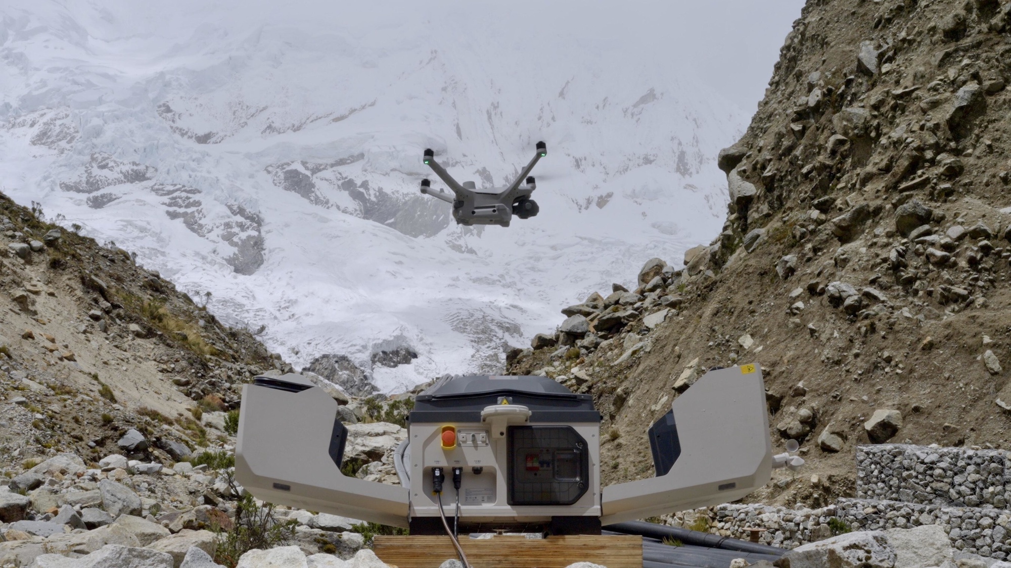
DJI has introduced a new application of its DJI Dock 3 system to support drone monitoring for avalanches and floods in the Peruvian Andes. The project focuses on glacier observation in high altitude regions where melting ice, unstable terrain, and extreme weather conditions create serious risks for nearby communities. By using automated drone operations, local teams are able to collect critical data without placing people in dangerous environments.
The DJI Dock 3 allows drones to operate autonomously in remote mountain areas where traditional monitoring methods can be slow or difficult to maintain. The system provides a protected base for the aircraft, enabling scheduled flights, automatic charging, and real time data transmission. According to DJI, the technology helps researchers and emergency planners track glacier movement, ice loss, and potential hazards that could lead to avalanches or sudden flooding.
“DJI Dock 3 enables fully automated aerial monitoring in some of the world’s most challenging environments, helping teams collect critical data while keeping personnel out of harm’s way.” DJI Representative
Automated Drone Operations Improve Glacier Observation And Risk Assessment
Glaciers in the Peruvian Andes have been retreating at an accelerated rate, increasing the likelihood of avalanches and glacial lake outburst floods. Monitoring these changes requires frequent data collection across steep and unstable terrain. The DJI Dock 3 system allows drones to fly pre programmed routes that capture high resolution images and terrain data on a regular schedule. This consistent monitoring helps scientists detect early warning signs of ice movement or water buildup.
The autonomous nature of the system is especially important in regions where access can be limited by weather or altitude. Instead of sending personnel into hazardous areas, operators can launch drones remotely from safer locations. The data collected can be shared quickly with researchers and emergency management teams, improving response planning and helping authorities take preventive action before conditions worsen.
Drone Monitoring Plays Growing Role In Disaster Preparedness And Climate Response
Drone monitoring for avalanches and floods is becoming an important tool as climate change increases environmental instability in mountain regions. Automated systems like DJI Dock 3 allow long term observation without the constant need for on site crews. This reduces costs while improving the reliability of data collection. In the Andes, where communities depend on early warnings to prepare for potential disasters, access to timely information can help protect lives and infrastructure.
The use of drone technology also supports collaboration between scientists, local governments, and emergency responders. By sharing aerial data, teams can better understand how glaciers are changing over time and how those changes may affect downstream areas. DJI views this project as an example of how autonomous drone systems can support environmental monitoring and disaster prevention efforts worldwide.
As extreme weather events become more frequent, technologies that allow safe and continuous observation are expected to play a larger role in disaster preparedness. DJI Dock 3 demonstrates how drones can be used not only for imaging, but as part of an integrated system that supports long term monitoring and informed decision making in some of the most challenging environments on the planet.
