

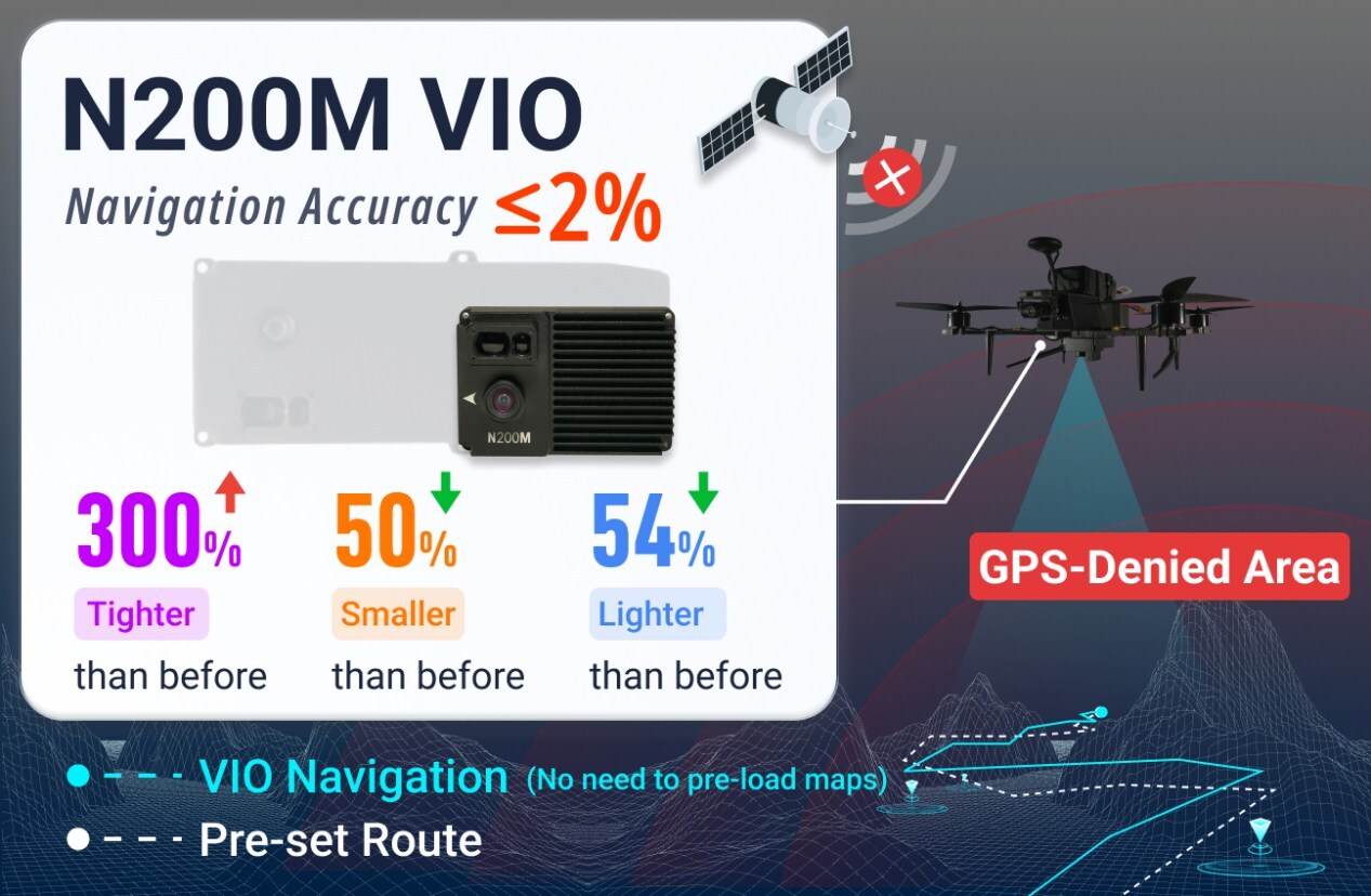
GPS-denied drone navigation just got a serious upgrade with the launch of the UNIBIRD N200M Visual Navigation Module, an AI-powered positioning system designed for drones that operate where satellite signals are unavailable, unreliable, or actively jammed. The module builds on the company’s original N200 system and delivers major improvements in size, weight, and positioning accuracy while keeping the price at $399.
GPS is the standard way most drones figure out where they are. But in places like indoor warehouses, urban canyons surrounded by tall buildings, underground structures, or areas where GPS signals are being intentionally blocked or spoofed, satellite navigation falls apart completely. When a drone loses GPS, it can drift, become unstable, or lose the ability to hold position. That is a serious problem in both commercial and defense applications, and the N200M is built to solve exactly that. UNIBIRD is headquartered in Dubai and combines Asia-Pacific research, development, and manufacturing to deliver AI-powered navigation hardware at accessible price points.
The original N200 was marketed as the world’s first mass-produced VIO (Visual-Inertial Odometry) navigation module at its price point. The N200M is the next evolution of that product, with the same $399 price tag but significantly better performance across nearly every specification. UNIBIRD says the module is now available for large-scale commercial orders, enabling a wide range of drones to execute precise autonomous missions in demanding GPS-denied environments.
GPS-Denied Drone Navigation Performance Sees Major Improvements
The N200M delivers three standout improvements over its predecessor. First, the module is 43% smaller, measuring 92 x 62 x 37.3 mm, which makes it easier to fit into a wider range of drone platforms. Second, it is 54% lighter, coming in at just 128 grams, which matters for drones where every gram affects battery life and total flight time. Third, the N200M achieves a 300% improvement in accuracy, keeping continuous positioning error within 2%. That level of precision without any GPS signal is a significant leap forward, especially at this price point, which sits at roughly one-twentieth the cost of traditional fiber-optic inertial navigation systems.
The module operates at altitudes up to 200 meters, or about 656 feet, which is four times higher than the 46-meter ceiling that limits many comparable visual navigation systems on the market today. It supports flight speeds up to 15 meters per second, roughly 54 kilometers per hour, while maintaining stable localization. The system outputs position data at 30 Hz with latency as low as 28 milliseconds, keeping drone response times fast enough for real-world autonomous operations. To maintain positioning without GPS, the N200M tightly couples data from vision sensors, laser ranging hardware, and an IMU (Inertial Measurement Unit), with adaptive feature-tracking algorithms holding 2% positioning accuracy even under strong electromagnetic interference or GPS spoofing.
SLAM Technology Lets the N200M Navigate Unknown Environments Without a Preloaded Map
One of the most technically interesting features of the N200M is that it does not require preloaded maps to work. The module uses SLAM, which stands for Simultaneous Localization and Mapping, a technology that lets a device build a map of an unknown environment in real time while simultaneously tracking its own position within that map. The N200M combines vision, IMU, and LiDAR data to perceive its surroundings and track position and orientation as it moves, meaning a drone can fly into a completely unfamiliar space with no GPS and no pre-built map and still navigate stably and autonomously.
Deployment is also designed to be fast and straightforward. The N200M follows the MAVLink standard protocol and connects directly to PX4 or APM flight controllers, which are two of the most widely used open-source flight control platforms in the drone industry. According to the announcement, integration takes only a few minutes and requires minimal PID tuning before the system is ready to fly. That plug-and-play approach lowers the barrier for operators and developers who want to add GPS-denied drone navigation capability to an existing platform without a complex integration process, making the N200M a practical option for commercial fleets, research programs, and field operations that require reliable autonomous performance in challenging environments.
