

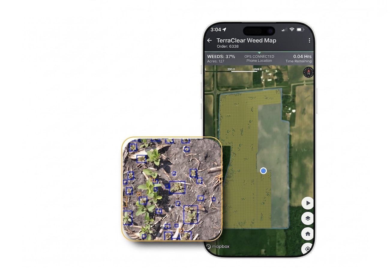
TerraClear, an Issaquah, Washington based agriculture technology company, has launched a specialized Giant Ragweed Mapping Service built specifically for large scale organic row crop operations. TerraClear drone mapping combines aerial imagery with artificial intelligence to pinpoint individual ragweed escapes that slip through early season management, giving organic growers a tool to act on precise GPS coordinates instead of guessing where weeds are hiding. The new service is now booking acres for the 2026 summer flight window.
For organic operations, giant ragweed is often described as a 10-year disaster waiting to happen. A single plant can release as many as 10,000 seeds, building a multi-year seed bank that drags down future yields and forces growers to invest more time and money each season trying to keep populations in check. Until now, the standard response has been blanket scouting and walking crews, an approach that can cost between 20 and 50 dollars per acre and still miss isolated escapes that quietly produce the next generation of weeds.
How TerraClear Drone Mapping Replaces Blanket Scouting
The service is built around the idea that a single ragweed plant identified late in the season can wreck an entire field the following year. The TerraClear drone mapping platform flies high precision aerial imaging over fields and processes the data through an AI model trained to recognize giant ragweed, then delivers exact GPS locations of each escape. Farm managers can review the results on the company’s ragweed map service page and dispatch workers directly to the problem plants instead of paying crews to walk hundreds of acres looking for trouble. The company describes the shift as moving from blanket coverage to a surgical sniper approach.
“Finding labor that can effectively scout and remove weeds in late-stage corn is nearly impossible today. Why pay a crew to walk 100 acres when the problem is only five individual plants? We are not just finding weeds. TerraClear is now providing a command center tool that allows farm managers to direct labor with total confidence. This ensures not a single escape goes to seed.” Don Scibner, Director of Product, TerraClear
According to TerraClear, the approach also changes how farm labor is used during the busiest stretch of the season. Walking crews become a precision strike team instead of a brute force scouting tool, with each worker sent to a confirmed problem location. Just as drone fleets in other parts of the industry now help farmers plant and harvest crops, TerraClear’s mapping output works in soybeans as well as corn. Growers can use a single product to reduce manual walking across multiple crops on the same farm and avoid sending crews into clean acres.
Targeting the Critical Seed Drop Window
Timing is central to the service. TerraClear schedules its drone flights for the late July and early August window, the stretch just before giant ragweed plants begin dropping viable seeds. Catching escapes during that period prevents new seeds from entering the soil and stops combines from carrying ragweed seed across the rest of the farm during harvest. For growers who already invest heavily in early season cultivation and walking crews, identifying late-stage patches at the right moment is often what determines whether a weed problem ends or expands.
TerraClear lists several specific benefits tied to the late summer flight window. Maps deliver precision validation by showing exactly where each escape sits in the field. Crews save time because they can skip clean acres entirely. Identifying weed patches before harvest protects the integrity of the next year’s crop by preventing seed spread across acres the combine touches. The company also highlights savings on soybean walkers, since growers can check pressure first and decide whether walking the entire field is even necessary.
“When one plant today equals a disaster tomorrow, good enough scouting is not an option. Having a GPS map means I stop guessing and start managing.” Alex Hopkins, organic grower in North Central Illinois
TerraClear is currently accepting bookings for the 2026 summer mapping window, with slots described as limited. The launch builds on the company’s earlier work in rock mapping and rock picking, and reflects a broader push to combine drone imagery, AI, and robotics into tools that take on the most labor-intensive parts of row crop production.
